Category:Maps of Kerala
Jump to navigation
Jump to search
States of India: Andhra Pradesh · Arunachal Pradesh · Assam · Bihar · Chhattisgarh · Goa · Gujarat · Haryana · Himachal Pradesh · Jharkhand · Karnataka · Kerala · Madhya Pradesh · Maharashtra · Manipur · Meghalaya · Mizoram · Nagaland · Odisha · Punjab · Rajasthan · Sikkim · Tamil Nadu · Telangana · Tripura · Uttar Pradesh · Uttarakhand · West Bengal
Union territories: Andaman and Nicobar Islands · Chandigarh · Dadra and Nagar Haveli and Daman and Diu · Delhi · Jammu and Kashmir · Ladakh · Lakshadweep · Puducherry ·
Former states of India: Jammu and Kashmir ·
Former union territories: Dadra and Nagar Haveli district · Daman and Diu ·
Union territories: Andaman and Nicobar Islands · Chandigarh · Dadra and Nagar Haveli and Daman and Diu · Delhi · Jammu and Kashmir · Ladakh · Lakshadweep · Puducherry ·
Former states of India: Jammu and Kashmir ·
Former union territories: Dadra and Nagar Haveli district · Daman and Diu ·
Wikimedia category | |||||
| Upload media | |||||
| Instance of | |||||
|---|---|---|---|---|---|
| Category combines topics | |||||
| Kerala | |||||
Indian state | |||||
| Instance of |
| ||||
| Part of | |||||
| Location | India | ||||
| Located in or next to body of water | |||||
| Capital | |||||
| Basic form of government |
| ||||
| Legislative body | |||||
| Executive body | |||||
| Official language | |||||
| Head of state |
| ||||
| Head of government | |||||
| Inception |
| ||||
| Highest point | |||||
| Population |
| ||||
| Area |
| ||||
| Replaces |
| ||||
| Different from | |||||
| official website | |||||
 | |||||
Subcategories
This category has the following 21 subcategories, out of 21 total.
*
B
- Blank maps of Kerala (6 F)
C
- Constituency maps of Kerala (23 F)
D
- Demographic maps of Kerala (7 F)
E
L
- Location maps of Kerala (6 F)
M
N
O
- OpenStreetMap maps of Kerala (5 F)
S
- Sky Maps of Kerala (10 F)
T
W
Media in category "Maps of Kerala"
The following 38 files are in this category, out of 38 total.
-
0-keralam.svg 744 × 1,098; 158 KB
-
1-keralam.svg 700 × 1,200; 813 KB
-
Ay Kingdom.png 800 × 934; 122 KB
-
Dot map of places of worship in Kerala.png 914 × 1,374; 540 KB
-
Idukki Lok Sabha Constituency.jpg 794 × 1,123; 369 KB
-
India 1760-es.svg 2,151 × 2,546; 2.32 MB
-
India Kerala relief map.png 828 × 1,205; 933 KB
-
Kerala Bird Species (2021) vs Silver Line.png 2,365 × 3,421; 532 KB
-
Kerala ecozones map labelled3-ar.png 1,192 × 1,546; 195 KB
-
Kerala ecozones map labelled3.png 683 × 890; 40 KB
-
Kerala ecozones map labelled3.svg 744 × 1,052; 160 KB
-
Kerala forest divisions.pdf 1,754 × 2,481; 475 KB
-
Kerala forest types.pdf 2,481 × 3,508; 549 KB
-
Kerala geographic map.png 468 × 695; 364 KB
-
Kerala India multi hazard zones map.PNG 570 × 1,001; 26 KB
-
Kerala outline map.png 251 × 420; 9 KB
-
Kerala outline shape.svg 300 × 300; 65 KB
-
Kerala population density map.jpg 251 × 420; 10 KB
-
Kerala profile map.PNG 248 × 413; 7 KB
-
Kerala soil map NBSS.png 7,557 × 10,425; 102.81 MB
-
Kerala Threatened Bird Species (2021) vs Silver Line.png 2,365 × 3,421; 520 KB
-
Kerala topo deutsch.png 425 × 509; 346 KB
-
Kerala worldcloud.png 1,024 × 1,024; 301 KB
-
Kozhikode district in 1961.svg 792 × 1,135; 1.43 MB
-
Malabar 1854.jpg 5,259 × 6,171; 18.28 MB
-
Malabar Map.png 5,927 × 7,419; 96.47 MB
-
Njaralappuzha Route.jpg 595 × 454; 51 KB
-
Pamba-Achankovil-Vaippar-river-link-project.jpg 640 × 479; 49 KB
-
Root map.jpg 1,117 × 629; 94 KB
-
Staloysiuscollegemap.jpg 737 × 1,024; 84 KB
-
Territory of Chera Dynasty.png 800 × 934; 124 KB
-
The districts of Kerala-ar.png 829 × 874; 83 KB
-
Topography of Kerala.png 468 × 695; 327 KB
-
Travancore 1854.jpg 5,328 × 8,064; 20.39 MB
-
Tulunad Map.jpg 2,560 × 2,560; 362 KB
-
Tulunad Region Map.jpg 2,560 × 2,560; 395 KB
-
Tulunad.jpg 2,560 × 2,560; 274 KB
-
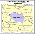
Tvm-poovachal.jpg 345 × 336; 33 KB

.svg/230px-Kerala_in_India_(claimed_and_disputed_hatched).svg.png)


_vs_Silver_Line.png/83px-Kerala_Bird_Species_(2021)_vs_Silver_Line.png)


_vs_Silver_Line.png/83px-Kerala_Threatened_Bird_Species_(2021)_vs_Silver_Line.png)


