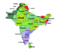
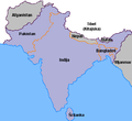
Category:Maps of South Asia
Jump to navigation
Jump to search
Wikimedia category | |||||
| Upload media | |||||
| Instance of | |||||
|---|---|---|---|---|---|
| Category combines topics | |||||
| South Asia | |||||
southern region of Asia | |||||
| Instance of | |||||
| Part of | |||||
| Located in or next to body of water | |||||
| Has part(s) | |||||
| Highest point | |||||
| Said to be the same as | Indian subcontinent | ||||
 | |||||
Subcategories
This category has the following 11 subcategories, out of 11 total.
Media in category "Maps of South Asia"
The following 75 files are in this category, out of 75 total.
-
Persian Plateau.png 717 × 430; 484 KB
-
2010 India Storm Map.png 760 × 532; 126 KB
-
Reversed Map of South Asia.gif 2,000 × 2,156; 2.18 MB
-
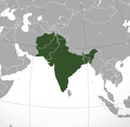
Akhand Bharat (orthographic projection).png 2,048 × 2,048; 1.21 MB
-
Akhand Bharat (orthographic projection).svg 2,048 × 2,048; 1.62 MB
-
Akhand Bharat.jpg 2,048 × 2,048; 473 KB
-
Bamboo network.jpg 1,080 × 820; 181 KB
-
BBIN.png 1,024 × 1,024; 564 KB
-
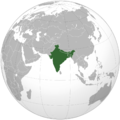
British India (orthographic projection).png 1,443 × 1,443; 531 KB
-
British India (orthographic projection).svg 550 × 550; 2.8 MB
-
Character-sphere.png 350 × 292; 6 KB
-
DEMTibet annotated.png 3,145 × 1,763; 6.77 MB
-
DEMTibet.png 3,145 × 1,763; 8.73 MB
-
Desi Muslims.jpg 516 × 674; 72 KB
-
Desi Muslims.png 521 × 701; 21 KB
-
Eastern World.PNG 1,903 × 837; 188 KB
-
Eastern World.svg 2,560 × 1,314; 1.12 MB
-
Eez pmn.jpg 435 × 369; 341 KB
-
Electricity Regulators in South Asia.JPG 896 × 766; 47 KB
-
Ethnolinguistic groups in Afghanistan.jpg 2,048 × 1,874; 334 KB
-
Global sea levels and vegetation during the last Ice Age (South Asia).jpg 1,420 × 2,062; 1.71 MB
-
Hindu-Kush.jpg 1,740 × 1,278; 1.85 MB
-
India 78.40398E 20.74980N.jpg 1,280 × 958; 167 KB
-
India and its neighbours.jpg 1,632 × 1,845; 390 KB
-
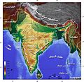
India Geographic Map-ar.jpg 1,440 × 1,388; 738 KB
-
India Geographic Map.jpg 1,440 × 1,388; 809 KB
-
IST-CIA-TZ.png 429 × 459; 51 KB
-
Karta indiska halvon.jpg 400 × 367; 14 KB
-
Koppen-Geiger Map Southern Asia future.svg 1,400 × 850; 2.96 MB
-
LocationSouthAsia.PNG 1,357 × 628; 45 KB
-
Map of Akhand Bharat.jpg 1,500 × 1,331; 462 KB
-
Map of Pakistan, Bangladesh, India and Sri Lanka.jpg 1,323 × 862; 312 KB
-
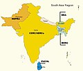
Map of South Asia (SAARC country).jpg 518 × 500; 67 KB
-
Map of South-India and Sri Lanka - Kanchipuram.png 237 × 259; 24 KB
-
Map of South-India and Sri Lanka - Kochi.png 237 × 259; 24 KB
-
Map of South-India and Sri Lanka.png 237 × 259; 24 KB
-
Map of the Khaljis of Bengal.png 2,324 × 2,151; 6.58 MB
-
Marathe.jpg 400 × 411; 28 KB
-
Mittlerer Osten Karte.png 681 × 393; 14 KB
-
Monde indien langues.png 490 × 555; 110 KB
-
Natural vegetation South Asia.png 746 × 429; 95 KB
-
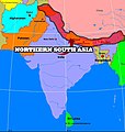
Northern south asia.jpg 712 × 750; 451 KB
-
PAT - South Asia.gif 2,000 × 1,500; 777 KB
-
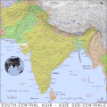
PAT - South-Central Asia.gif 1,900 × 1,900; 945 KB
-
Presentation1 1696666311.jpg 1,280 × 720; 143 KB
-
PunjabDoabs.png 1,583 × 1,135; 1.1 MB
-
SASEC South Asia Subregional Economic Cooperation.png 1,971 × 1,269; 43 KB
-
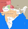
Sher Shah's empire.png 424 × 555; 22 KB
-
Sikkim and Bhutan 1910.jpg 4,958 × 3,638; 22.17 MB
-
South Asia (definitions).png 6,460 × 3,613; 1.27 MB
-
South Asia (ed)update.PNG 681 × 393; 180 KB
-
South Asia (orthographic projection) with national boundaries.png 1,443 × 1,443; 530 KB
-
South Asia Altitude.svg 800 × 730; 8.14 MB
-
South Asia common definition.jpg 541 × 541; 64 KB
-
South Asia countries.png 514 × 381; 49 KB
-
South Asia subdivisions flood hit between July 3 and August 15 2007.png 1,293 × 1,199; 66 KB
-
South Asia UN.png 2,960 × 3,588; 1.63 MB
-
South asia.jpg 425 × 533; 52 KB
-
South Asian Language Families.jpg 637 × 695; 49 KB
-
South Asian Language Families.png 1,000 × 1,201; 123 KB
-
Southern Asia.png 536 × 800; 140 KB
-
States of South Asia 1.png 725 × 684; 126 KB
-
States of South Asia by language.png 798 × 752; 96 KB
-
Südasien Sprachfamilien-nb.png 877 × 953; 42 KB
-
Südasien Sprachfamilien.png 877 × 953; 20 KB
-
Txu-oclc-10552568-nh46-12.jpg 5,000 × 3,800; 4.96 MB
-
Txu-oclc-10552568-nh47-13.jpg 5,000 × 3,790; 4.28 MB
-
Txu-oclc-10552568-nh47-9.jpg 5,000 × 3,794; 4.08 MB
-
Txu-oclc-6654394-ng-47-6th-ed.jpg 5,000 × 4,723; 9.54 MB
-
Txu-oclc-6654394-ni-44-3rd-ed.jpg 4,592 × 4,305; 6.06 MB
-
Txu-oclc-6654394-nj-44-3rd-ed.jpg 4,904 × 5,343; 5.89 MB
-
Zemljevid Indijska podcelina.png 400 × 367; 8 KB
-
Ю.Азия.png 681 × 393; 22 KB
-
خريطة كتاب سندباد عصري 1938.png 1,241 × 922; 2.18 MB
_without_national_boundaries.svg/230px-South_Asia_(orthographic_projection)_without_national_boundaries.svg.png)
.jpg/230px-Map_of_South_Asia_(SAARC_country).jpg)


.png/120px-Akhand_Bharat_(orthographic_projection).png)
.svg/120px-Akhand_Bharat_(orthographic_projection).svg.png)


.png/120px-British_India_(orthographic_projection).png)
.svg/120px-British_India_(orthographic_projection).svg.png)



.jpg/82px-Global_sea_levels_and_vegetation_during_the_last_Ice_Age_(South_Asia).jpg)




.jpg/120px-Map_of_South_Asia_(SAARC_country).jpg)







.png/120px-South_Asia_(definitions).png)
update.PNG/120px-South_Asia_(ed)update.PNG)
_with_national_boundaries.png/120px-South_Asia_(orthographic_projection)_with_national_boundaries.png)


