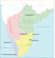
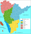
Category:Maps of South India
Jump to navigation
Jump to search
Wikimedia category | |||||
| Upload media | |||||
| Instance of | |||||
|---|---|---|---|---|---|
| Category combines topics | |||||
| South India | |||||
geographic region in India | |||||
| Instance of | |||||
| Location | India | ||||
| Has part(s) | |||||
| Population |
| ||||
| Area |
| ||||
 | |||||
Subcategories
This category has the following 17 subcategories, out of 17 total.
*
A
C
E
G
K
L
M
P
S
T
W
Media in category "Maps of South India"
The following 24 files are in this category, out of 24 total.
-
India Political Map South India.svg 690 × 726; 617 KB
-
India South India Locator Map.svg 1,639 × 1,852; 1.44 MB
-
Magnetic isoclines India.jpg 2,752 × 4,125; 1.17 MB
-
Malabar 1854.jpg 5,259 × 6,171; 18.28 MB
-
Regions of south india.gif 2,529 × 2,722; 1.69 MB
-
S India 1759.jpg 4,467 × 6,640; 11.05 MB
-
South India 1832.jpg 4,264 × 3,300; 13.88 MB
-
South India 1854.jpg 10,554 × 14,213; 30.97 MB
-
South India 2017 map.jpg 1,594 × 1,868; 151 KB
-
South India Johnston.jpg 8,401 × 6,748; 56.52 MB
-
South India PolMap,.jpg 529 × 456; 59 KB
-
South India satellite.jpg 1,400 × 1,800; 602 KB
-
South India, 1744.jpg 3,523 × 6,090; 3.75 MB
-
South India.svg 1,574 × 1,792; 340 KB
-
South Indian territories 2014 de.svg 676 × 749; 279 KB
-
South Indian territories 2014-fr.svg 672 × 746; 290 KB
-
Southern India WV.svg 470 × 541; 999 KB
-
SouthIndia.png 1,096 × 1,280; 225 KB
-
SouthIndia2009.PNG 1,951 × 2,159; 557 KB
-
SouthIndiaGeology.svg 1,100 × 1,501; 114 KB
-
Southindiaregionsweb.png 790 × 794; 167 KB
-
Topographic map of Tamil Nadu.jpg 1,218 × 1,078; 1.4 MB
-
Vernay Map.jpg 1,778 × 2,340; 2.39 MB


