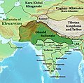
Category:Maps of the Ghurid Empire
Jump to navigation
Jump to search
Media in category "Maps of the Ghurid Empire"
The following 11 files are in this category, out of 11 total.
-
Asia 1200ad.jpg 1,968 × 1,215; 731 KB
-
DinastíaGúrida1149-1212-fa.svg 982 × 685; 200 KB
-
DinastíaGúrida1149-1212.svg 982 × 685; 147 KB
-
Eldiguzids-1175.png 1,122 × 595; 83 KB
-
Ghori Dynasty 1149-1212 (AD).png 620 × 428; 20 KB
-
Ghurid dynasty (greatest extent).svg 553 × 553; 270 KB
-
Ghurid Empire according to Schwartzberg Atlas, p.147.png 3,524 × 2,418; 19.16 MB
-
Ghurid Sultanate circa 1200 CE.jpg 695 × 685; 484 KB
-
Ghurids1200.png 1,644 × 959; 28 KB
-
Iran-Ghurids.jpg 2,516 × 1,414; 720 KB
-
Iszlám világ 1200k.jpg 2,339 × 1,654; 544 KB


.png/120px-Ghori_Dynasty_1149-1212_(AD).png)
.svg/120px-Ghurid_dynasty_(greatest_extent).svg.png)


