Category:Maps of the history of Asia
Jump to navigation
Jump to search
Temperate regions: North America · South America · Africa · Europe · Asia · Oceania – Polar regions:
Wikimedia category | |||||
| Upload media | |||||
| Instance of | |||||
|---|---|---|---|---|---|
| |||||
Use the appropriate category for maps showing all or a large part of Asia. See subcategories for smaller areas:
| If the map shows | Category to use |
|---|---|
| Asia on a recently created map | Category:Maps of Asia or its subcategories |
| Asia on a map created more than 70 years ago | Category:Old maps of Asia or its subcategories |
| the history of Asia on a recently created map | Category:Maps of the history of Asia or its subcategories |
| the history of Asia on a map created more than 70 years ago | Category:Old maps of the history of Asia or its subcategories |
Subcategories
This category has the following 30 subcategories, out of 30 total.
!
*
.
A
C
D
E
K
L
M
- Maps of the Silk Road (54 F)
- Maps of Tuyuhun (2 F)
P
S
T
- Maps of the Timurid Empire (95 F)
W
Media in category "Maps of the history of Asia"
The following 200 files are in this category, out of 205 total.
(previous page) (next page)-
MigracionesDeLosYueh-Chih.svg 521 × 401; 530 KB
-
Yueh-ChihMigrations.jpg 672 × 504; 46 KB
-
1150Azie.jpg 914 × 706; 45 KB
-
1650Azie.jpg 914 × 709; 48 KB
-
1750azie.jpg 914 × 709; 47 KB
-
1833 Malte-Brun Map of Asia in Ancient Times - Geographicus - AsiaAncient-mb-1837.jpg 2,244 × 1,695; 649 KB
-
1900azie.jpg 914 × 709; 51 KB
-
Second world war asia 1937-1942 map de.png 1,298 × 998; 137 KB
-
Second world war asia 1943-1945 map de.png 1,298 × 998; 193 KB
-
Second world war asia 1943-1945 map pl2.png 1,300 × 1,000; 214 KB
-
Second world war asia 1943-1945 map fr-1.png 3,296 × 2,535; 621 KB
-
1945azie.jpg 914 × 709; 52 KB
-
3-й Уйгурский каганат.png 792 × 375; 66 KB
-
East-Hem 323bc.jpg 3,240 × 1,903; 712 KB
-
Asia 500ad.jpg 2,196 × 1,305; 435 KB
-
East-Hem 500bc.jpg 3,240 × 1,903; 1.41 MB
-
Van Lang 500 BCE.jpg 1,514 × 1,017; 117 KB
-
800px-Tang map.JPG 799 × 461; 63 KB
-
A magyarok vandorlasa.jpg 1,248 × 1,074; 248 KB
-
A new universal atlas of the world.Asia.jpg 3,172 × 2,497; 1.59 MB
-
Ancient NE Asian Languages.png 935 × 1,039; 1.47 MB
-
Ancient Northeast Asians (area map).png 3,196 × 1,840; 13.16 MB
-
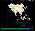
AncientCitiesTimelineAsiav3.svg 1,320 × 1,171; 1.02 MB
-
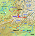
AncientRoad between Indus and AmuDarya.png 414 × 425; 409 KB
-
ANEA map日本語.jpg 1,798 × 1,147; 578 KB
-
Aryan Peoples.jpg 753 × 629; 60 KB
-
Asia 001ad.jpg 2,048 × 1,181; 751 KB
-
Asia 100bc.jpg 2,053 × 1,196; 760 KB
-
Asia 1200ad.jpg 1,968 × 1,215; 731 KB
-
Asia 1300bc.jpg 2,007 × 1,125; 893 KB
-
Asia 13th Century.pdf 1,650 × 1,275; 3.57 MB
-
Asia 1914-1938-1950.jpg 1,140 × 1,485; 616 KB
-
Asia 200ad.jpg 1,910 × 1,209; 758 KB
-
Asia 400ad (cropped).jpg 754 × 633; 184 KB
-
Asia 400ad.jpg 1,990 × 1,211; 790 KB
-
Asia 565ad.jpg 2,379 × 1,291; 448 KB
-
Asia 700ad.jpg 1,953 × 1,166; 361 KB
-
Asia 900ad.jpg 2,222 × 1,518; 855 KB
-
Asia history map 0001.png 2,400 × 1,745; 769 KB
-
Asia in 1335 cn en.png 866 × 394; 123 KB
-
Asia in 1345.svg 1,100 × 837; 1.02 MB
-
Asia in 1900.png 3,915 × 3,063; 4 MB
-
ASIA IN 300 BCE.jpg 1,624 × 1,066; 658 KB
-
Bartholomew J. G. - A literary & historical atlas of Asia (1912).pdf 997 × 1,543, 252 pages; 25.81 MB
-
Battle of Meggido (15th century BC) - Egyptian attack.jpg 4,000 × 2,824; 1.96 MB
-
Battle of Megiddo (15th century BC) - Routes.jpg 2,816 × 3,560; 1.57 MB
-
Bengal, Asia.jpg 626 × 600; 134 KB
-
Better version greater east asia japanese influence.png 744 × 544; 81 KB
-
Blankmap-ao-270W-asia65.png 726 × 726; 53 KB
-
British empire in east.png 580 × 301; 17 KB
-
Buddhist Expansion.svg 512 × 473; 740 KB
-
CarteCanaanAuBronzeRécent.jpg 2,901 × 3,930; 1.58 MB
-
Central Asia 432 AH Arabic.PNG 742 × 458; 67 KB
-
Central Asia in the Han Dynasty.PNG 1,022 × 566; 1.31 MB
-
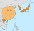
China, Vietnam, Korea and Japan in 1100 AD.svg 512 × 465; 127 KB
-
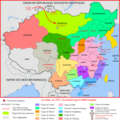
Chine 1911-1916.png 4,000 × 4,000; 3.29 MB
-
Chine 1921-1922.png 4,000 × 4,000; 2.7 MB
-
Culturas antiguas.jpg 944 × 374; 59 KB
-
Das Reich der Kirgisen (810-840).png 752 × 654; 90 KB
-
Didzioji orda.svg 830 × 677; 40 KB
-
Dulat`s land.png 804 × 496; 106 KB
-
Dutch and Portuguese in Asia c 1665.png 617 × 473; 30 KB
-
Dutch and Portuguese in Asia c. 1665-cs.svg 771 × 591; 191 KB
-
Early Iron Age Southern Siberian Ancestries.png 1,303 × 762; 887 KB
-
East India Islands (1827).jpg 781 × 545; 232 KB
-
East-Hem 475ad.jpg 3,240 × 1,903; 753 KB
-
East-Hem 476ad.jpg 3,240 × 1,903; 754 KB
-
East-Hem 477ad.jpg 3,240 × 1,903; 760 KB
-
EastAsia1100AD.png 736 × 594; 716 KB
-
Empires in Asia and Oceania 1932.png 1,614 × 921; 172 KB
-
Europa del este medieval.png 453 × 500; 304 KB
-
Funan Kingdom.png 803 × 482; 49 KB
-
Gangaridai 326 BC Nanda Empire.svg 2,000 × 1,355; 4.54 MB
-
Hephthaliten.png 1,253 × 746; 1.43 MB
-
Herodotus's world (Central Asia).png 567 × 425; 464 KB
-
Hinduism Expansion in Asia de.svg 1,060 × 791; 845 KB
-
Hinduism Expansion in Asia-es.svg 512 × 382; 1.28 MB
-
Hinduism Expansion in Asia-hu.svg 512 × 382; 824 KB
-
Hinduism Expansion in Asia-id.svg 512 × 382; 779 KB
-
Hinduism Expansion in Asia-pt.svg 512 × 382; 826 KB
-
Hinduism Expansion in Asia-zh-hans.svg 512 × 382; 779 KB
-
Hinduism Expansion in Asia.svg 512 × 382; 769 KB
-
Historical Europe-Asia boundaries 1700 to 1900.png 309 × 562; 75 KB
-
Houghton Ind 595.52.10 - João de Barros.jpg 1,081 × 1,597; 892 KB
-
Immigrations of Yuechies in Central Asia between BCE 176 and CE 30.png 882 × 605; 234 KB
-
Indo-Iranian origins.png 581 × 530; 414 KB
-
Iran-anarchy era-es.svg 3,618 × 3,042; 3.67 MB
-
Iran-anarchy era.svg 3,618 × 3,042; 1.39 MB
-
Japantowns.jpg 762 × 677; 77 KB
-
Karluken-Reich (766-999).PNG 752 × 591; 36 KB
-
Kasachen-Khanat.png 6,072 × 6,007; 9.48 MB
-
Khmer Empire.png 748 × 476; 46 KB
-
Kirgisen-Reich (840-924).PNG 1,253 × 781; 1.42 MB
-
Kuwait Republic 1874 Map.jpg 452 × 565; 67 KB
-
Later diffusion and contacts in Central Asia.png 1,594 × 750; 1.22 MB
-
LocationParthia.png 250 × 115; 9 KB
-
Map of Asia from the Interwar period, ca. 1932-36.jpg 1,600 × 1,200; 1.32 MB
-
Map of East India by Jodocus Hondius.jpg 1,344 × 978; 721 KB
-
Map of Kara Koyunlu Turcomans.jpg 1,109 × 615; 323 KB
-
Map of the Ancient North Eurasians.png 3,196 × 1,840; 13.22 MB
-
Map of the Ancient Northeast Asians.png 2,189 × 935; 4.95 MB
-
Map of the Asian North Eurasians (expansion).png 3,196 × 1,840; 13.3 MB
-
Map of the Khoshut Khanate (among other Mongol tribes).png 3,128 × 1,984; 12.41 MB
-
Map of the Kingdom of Khotan.png 3,196 × 1,840; 13.15 MB
-
Map of the Northern Yuan among other Mongols.jpg 1,908 × 1,064; 1.81 MB
-
Map of the Northern Yuan.png 3,196 × 1,840; 13.33 MB
-
Map of the Oirat Confederation.png 1,676 × 1,066; 3.54 MB
-
Map of the Oirats Confederation.png 3,228 × 1,858; 14.09 MB
-
Map of the Saka realm.png 3,196 × 1,840; 13.38 MB
-
Map of the Sakas.png 3,196 × 1,840; 13.31 MB
-
Map of the Slab Grave culture.png 3,196 × 1,840; 13.21 MB
-
Map of the United States of Indonesia-id.svg 786 × 361; 890 KB
-
Map of the United States of Indonesia.svg 786 × 361; 872 KB
-
Map of the Xianbei Empire and other tribes.jpg 1,500 × 704; 860 KB
-
Map of the Xianbei Empire.png 3,196 × 1,840; 13.21 MB
-
Map of the Yenisei Kyrgyz Khaganate.png 3,196 × 1,840; 13.15 MB
-
Map of Tĩnh Hải quân and early years of Ngô dynasty.png 650 × 800; 123 KB
-
Map of Vạn Xuân Kingdom during Early Lý dynasty.png 650 × 800; 80 KB
-
Marathe-es.svg 1,594 × 1,868; 329 KB
-
Marathe.jpg 400 × 411; 28 KB
-
Maritime Fur Trade-WorldContext.png 1,378 × 805; 232 KB
-
Mediterranea world200bc-es.svg 1,428 × 313; 76 KB
-
Mediterranea world200bc-pt.svg 1,428 × 313; 76 KB
-
Mediterraneans 1328.png 806 × 454; 39 KB
-
MigracionesDeLosYueh-Chih-pt.svg 521 × 401; 603 KB
-
Migracions vediques.png 566 × 556; 482 KB
-
Mongol and Oirat.png 850 × 567; 234 KB
-
Das Mongolenreich unter den Erben Dschingis Khans.GIF 752 × 591; 135 KB
-
Empire of Genghis Khan at his death.png 1,056 × 850; 1.14 MB
-
Genghis khan empire at his death.png 752 × 591; 41 KB
-
MongolEmpire hu.svg 700 × 366; 132 KB
-
MongolEmpire.jpg 700 × 366; 44 KB
-
Mongolen-Reich (1227-1295).PNG 752 × 590; 37 KB
-
Mongolernas välde mot slutet av 1200-talet.jpg 2,034 × 698; 629 KB
-
NE 500ad.jpg 1,424 × 1,049; 238 KB
-
NewMapL.jpg 7,735 × 5,326; 2.05 MB
-
Nogaj-horden (kart).svg 962 × 684; 114 KB
-
Nogaju orda.svg 962 × 684; 130 KB
-
Nogay Horde.svg 962 × 684; 131 KB
-
Obszar stepu pontyjskiego ok 650 AD.png 637 × 553; 37 KB
-
OldestCitiesContinuouslyInhabitedInWesternAsia.svg 1,297 × 780; 935 KB
-
OttomanEmpireIn1683tr.png 1,966 × 1,850; 327 KB
-
Parthia and Rome century2bc-es.svg 1,428 × 313; 46 KB
-
Parthia and Rome century2bc-pt.svg 512 × 121; 26 KB
-
Political map of West Asia 1600.png 2,400 × 1,745; 858 KB
-
Political map of West Asia 1789.png 2,400 × 1,745; 872 KB
-
Political map of West Asia 1870.png 2,400 × 1,745; 851 KB
-
Premongol.png 752 × 590; 31 KB
-
PremongolEurasia-ar.png 752 × 590; 60 KB
-
PremongolEurasia.png 752 × 590; 31 KB
-
Ptolemaic-Empire 200bc.jpg 1,164 × 636; 1.02 MB
-
Ptolemaic-Empire 200bcARABIC.JPG 800 × 437; 119 KB
-
Ptolemaic-Empire-300BC.jpeg 2,930 × 2,297; 1.57 MB
-
Ptolemaic-Empire-300BC.png 829 × 629; 528 KB
-
Qara Qoyunlu map.png 657 × 537; 386 KB
-
Radhanites.png 1,152 × 576; 1.02 MB
-
Ritterorden-Outremer-bis-1291.png 1,200 × 1,706; 174 KB
-
Roman-Empire 200bc.jpg 1,164 × 636; 887 KB
-
Rome-Seleucia-Parthia 200bc.jpg 1,205 × 567; 767 KB
-
Russia-India 1865.png 296 × 174; 8 KB
-
Russian conquests of Siberia.png 816 × 488; 14 KB
-
Schematic ethnogenesis of the Eastern Hunter-Gatherers (EHG)日本語.jpg 1,799 × 820; 555 KB
-
Schlacht bei Megiddo.jpg 510 × 510; 38 KB
-
SE Asia 400ad.jpg 1,475 × 1,092; 652 KB
-
Second world war asia 1937-1942 map pl.png 1,300 × 1,000; 390 KB
-
Second world war asia 1943-1945 map pl.png 1,300 × 1,000; 398 KB
-
Spread of buddism (ko).jpg 513 × 328; 39 KB
-
Tabaristan-EN.svg 800 × 582; 112 KB
-
Tabaristan-es.svg 800 × 582; 504 KB
-
Tabaristan-FA.svg 1,920 × 1,080; 112 KB
-
TARTARIA sive MAGNI CHAMI IMPERIVM.jpg 1,024 × 844; 1.18 MB
-
Uiguren-Reich (745-840).PNG 752 × 591; 37 KB
-
Umayyad-Empire.png 680 × 451; 24 KB
-
Uyghur khaganat larger expansion.png 800 × 433; 698 KB
-
Voor- en Achter-Indië (Bosatlas 1877, pl. XX, p. 67).png 379 × 297; 197 KB
-
Wielka Orda.svg 830 × 677; 40 KB
-
Wu-sun Lage.png 800 × 467; 826 KB
-
Yamna-cat.png 1,174 × 916; 345 KB
-
Yuezhi migrations.jpg 2,000 × 1,539; 458 KB
-
Yuezhi migrations.svg 1,376 × 1,058; 50 KB
-
Áise i 500.jpg 1,920 × 1,141; 591 KB
-
Большая Орда.png 828 × 768; 192 KB
-
Восточно-Тюркский каганат.png 684 × 326; 57 KB
-
Джунгарское ханство.png 1,555 × 913; 371 KB
-
Жужань.png 2,086 × 795; 219 KB
-
Караханидское государство.png 1,135 × 719; 162 KB
-
Карта части древней Азии Голицына.png 3,402 × 2,093; 5.11 MB
-
Кыргызский каганат.png 737 × 376; 68 KB
-
Мазендеран.png 1,040 × 480; 36 KB
-
Могулистан.png 1,640 × 1,017; 629 KB
-
Могулия.png 1,055 × 600; 254 KB
-
Парфия.png 990 × 695; 38 KB
-
Распад Золотой Орды.png 1,676 × 885; 569 KB
-
Саффариды 861-1003.png 620 × 429; 30 KB
-
Тюменское ханство.png 1,680 × 1,349; 606 KB


_-_Geographicus_-_AsiaXVXVI-spruneri-1855.jpg/120px-1844_Spruneri_Map_of_Asia_in_the_15th_and_16th_Centuries_(Ming_China)_-_Geographicus_-_AsiaXVXVI-spruneri-1855.jpg)
_-_Geographicus_-_AsienFunften-spruneri-1855.jpg/120px-1855_Spruner_Map_of_Asia_in_the_5th_Century_(_Sassanid_Empire_)_-_Geographicus_-_AsienFunften-spruneri-1855.jpg)


.png/120px-Ancient_Northeast_Asians_(area_map).png)


.jpg/120px-Asia_400ad_(cropped).jpg)


.pdf/page1-77px-Bartholomew_J._G._-_A_literary_%26_historical_atlas_of_Asia_(1912).pdf.jpg)
_-_Egyptian_attack.jpg/120px-Battle_of_Meggido_(15th_century_BC)_-_Egyptian_attack.jpg)
_-_Routes.jpg/95px-Battle_of_Megiddo_(15th_century_BC)_-_Routes.jpg)



.png/120px-Das_Reich_der_Kirgisen_(810-840).png)


.jpg/120px-East_India_Islands_(1827).jpg)




.png/120px-Herodotus%27s_world_(Central_Asia).png)



.PNG/120px-Karluken-Reich_(766-999).PNG)


.PNG/120px-Kirgisen-Reich_(840-924).PNG)


.png/120px-Map_of_the_Asian_North_Eurasians_(expansion).png)
.png/120px-Map_of_the_Khoshut_Khanate_(among_other_Mongol_tribes).png)


.jpg/120px-Map_of_Tibet_and_the_Empire_of_Kublai_Khan%2C_from-_Asia_13th_Century_(cropped).jpg)






.PNG/120px-Mongolen-Reich_(1227-1295).PNG)


.svg/120px-Nogaj-horden_(kart).svg.png)





.jpg/120px-Prehistoric_migration_routes_for_Y-chromosome_Haplogroup_N_lineage_following_the_retreat_of_ice_sheets_after_the_Last_Glacial_Maximum_(22–18_kya).jpg)


日本語.jpg/120px-Schematic_ethnogenesis_of_the_Eastern_Hunter-Gatherers_(EHG)日本語.jpg)


.jpg/120px-Spread_of_buddism_(ko).jpg)


.PNG/120px-Uiguren-Reich_(745-840).PNG)


.png/120px-Voor-_en_Achter-Indië_(Bosatlas_1877%2C_pl._XX%2C_p._67).png)


