Category:Maps of the history of India
Jump to navigation
Jump to search
Countries of Asia: Afghanistan · Armenia‡ · Azerbaijan‡ · Bahrain · Bangladesh · Bhutan · Brunei · Cambodia · People's Republic of China · Cyprus‡ · East Timor · Egypt‡ · Georgia‡ · India · Indonesia‡ · Iran · Iraq · Israel · Japan · Jordan · Kazakhstan‡ · Kuwait · Kyrgyzstan · Laos · Lebanon · Malaysia · Mongolia · Myanmar · Nepal · North Korea · Oman · Pakistan · Philippines · Qatar · Russia‡ · Saudi Arabia · Singapore · South Korea · Sri Lanka · Syria · Tajikistan · Thailand · Turkey‡ · Turkmenistan · United Arab Emirates · Uzbekistan · Vietnam · Yemen
Limited recognition: Abkhazia‡ · Taiwan · Northern Cyprus‡ · State of Palestine · South Ossetia‡
‡: partly located in Asia
Limited recognition: Abkhazia‡ · Taiwan · Northern Cyprus‡ · State of Palestine · South Ossetia‡
‡: partly located in Asia
States of India: Andhra Pradesh · Assam · Goa · Himachal Pradesh · Karnataka · Kerala · Maharashtra · Tamil Nadu · Telangana · West Bengal
Union territories: Dadra and Nagar Haveli and Daman and Diu · Delhi · Jammu and Kashmir · Ladakh · Puducherry ·
Former states of India:
Former union territories:
Union territories: Dadra and Nagar Haveli and Daman and Diu · Delhi · Jammu and Kashmir · Ladakh · Puducherry ·
Former states of India:
Former union territories:
Subcategories
This category has the following 62 subcategories, out of 62 total.
- Maps of 6th-century BC India (10 F)
- Maps of 5th-century BC India (10 F)
- Maps of 4th-century BC India (10 F)
- Maps of 3rd-century BC India (11 F)
- Maps of 2nd-century BC India (9 F)
- Maps of 1st-century BC India (3 F)
- Maps of 5th-century India (5 F)
- Maps of 6th-century India (5 F)
- Maps of 7th-century India (3 F)
- Maps of 9th-century India (6 F)
- Maps of 10th-century India (5 F)
- Maps of 11th-century India (1 F)
- Maps of 18th-century India (7 F)
- Maps of 19th-century India (1 F)
*
- SVG maps of the history of India (61 F)
.
1
C
- Maps of the Chola Empire (39 F)
D
- Maps of the Durrani Empire (13 F)
E
F
G
- Maps of the Ghaznavid Empire (30 F)
- Maps of the Ghurid Empire (11 F)
- Maps of the Gupta Empire (51 F)
- Maps of Gurjara-Pratihara (4 F)
H
I
- Maps of the Indo-Greek Kingdom (31 F)
K
- Maps of the Kumaon Kingdom (9 F)
- Maps of the Kushan Empire (26 F)
M
- Maps of Shunga Empire (15 F)
- Maps of the Sikh Empire (12 F)
- Maps of the Maratha Confederacy (53 F)
- Maukharis (17 F)
- Maps of the Mauryan Empire (82 F)
O
P
- Maps of Portuguese India (30 F)
R
- Maps of Rashtrakuta (10 F)
S
T
- Territorial evolution of India (32 F)
- Maps of the Timurid Empire (95 F)
W
Media in category "Maps of the history of India"
The following 140 files are in this category, out of 140 total.
-
Indus Valley Civilization, Mature Phase (2600-1900 BCE).png 900 × 733; 1.04 MB
-
Indien 1670.jpg 546 × 709; 201 KB
-
Kerala, Madras, Andhra, W Bengal and Punjab in 1964.png 1,048 × 1,360; 35 KB
-
A General Sketch of Political History from the Earlist Times - India.jpg 2,467 × 1,926; 849 KB
-
Ancient Indian Map.jpg 1,305 × 1,933; 540 KB
-
Ancient Kalinga location or.svg 1,639 × 1,852; 412 KB
-
Ancient Kalinga location.svg 1,639 × 1,852; 410 KB
-
Ancient Kalinga map.png 1,280 × 1,446; 528 KB
-
BahmaniEmpire.png 1,554 × 972; 56 KB
-
Basic Map of East Africa, c.1500.png 470 × 437; 22 KB
-
Carte de l'Inde Française de 1741 à 1754.png 1,044 × 1,287; 272 KB
-
Carte Guerre de 7 ans Inde.PNG 611 × 470; 25 KB
-
Catalogue of Historical Maps of Survey of India 1700-1900 by Prasad.pdf 1,131 × 1,579, 557 pages; 14.4 MB
-
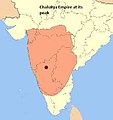
Chalukyan empire.jpg 218 × 232; 6 KB
-
Chera country (early historic south India).jpg 2,670 × 2,219; 878 KB
-
Chola empire spread.jpg 214 × 235; 6 KB
-
Civilizacion de l'Indus.png 922 × 715; 135 KB
-
Early Vedic Culture (1700-1100 BCE).png 1,000 × 770; 1.4 MB
-
ElliotHaukalSindMap2.jpg 1,441 × 2,321; 630 KB
-
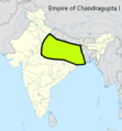
Empire of Chandragupta I.png 836 × 900; 275 KB
-
Empire of Kapilendra Deva Routraya.jpg 540 × 619; 119 KB
-
EpicIndia.jpg 1,002 × 1,176; 536 KB
-
F28-31-1.jpg 12,357 × 10,758; 6.96 MB
-
F28-31-2.jpg 12,286 × 9,962; 7.86 MB
-
F28-31-3.jpg 7,248 × 9,195; 3.68 MB
-
F28-31-4.jpg 7,390 × 10,410; 3.57 MB
-
Gana Sanghas (c. 500 BCE).jpg 1,630 × 1,000; 1.76 MB
-
Gonds3.jpg 690 × 671; 98 KB
-
Gujarat Jawadwipa maps.svg 1,000 × 670; 964 KB
-
Gujarat Jawadwipa.svg 1,100 × 837; 956 KB
-
Harsha2007a.jpg 800 × 655; 57 KB
-
Hirakhand State Balram Dev - Jayant Singh.jpg 2,400 × 2,588; 566 KB
-
Historical map of India AD 1531-ar.jpg 927 × 611; 135 KB
-
Historical Records of the Survey of India Vol.-3.pdf 1,816 × 2,641, 590 pages; 43.84 MB
-
Imperio Sij.JPG 800 × 655; 124 KB
-
India & Pakistan on eve of Independence.png 1,432 × 1,426; 41 KB
-
India - Division de la peninsula indiana au sègle I.png 468 × 601; 61 KB
-
India - Division de la peninsula indiana en 1858.png 553 × 521; 126 KB
-
India - Division de la peninsula indiana en 1939.png 587 × 526; 139 KB
-
India - Division de la peninsula indiana vèrs 1520.png 482 × 557; 108 KB
-
India - Division de la peninsula vèrs 1765.png 515 × 576; 135 KB
-
India - Empèri Mogòl au sègle XVII.png 463 × 539; 62 KB
-
India - Partiment de la peninsula indiana en 1947.png 863 × 742; 226 KB
-
India 250 BC.jpg 1,272 × 1,708; 2.04 MB
-
India 2nd century AD.jpg 1,265 × 1,704; 2.4 MB
-
India 350 AD.jpg 1,284 × 1,737; 2.6 MB
-
India 500 AD.jpg 1,277 × 1,725; 2.61 MB
-
India 500 BCE.jpg 1,000 × 771; 393 KB
-
India 7th century AD.jpg 1,272 × 1,719; 2.19 MB
-
India 900 CE.jpg 425 × 385; 205 KB
-
India After the Battle of Panipat (1526).png 2,000 × 1,125; 871 KB
-
India Buddha korában.png 429 × 502; 309 KB
-
India in 1525 Joppen.jpg 1,251 × 1,824; 335 KB
-
India in 1605-ar.jpg 1,189 × 1,711; 728 KB
-
India in 1605.jpg 1,248 × 1,832; 325 KB
-
India in 1700 Joppen.jpg 1,259 × 1,820; 298 KB
-
India in 477 CE.png 749 × 946; 1.03 MB
-
India-naturalhazards-map fr.png 350 × 427; 72 KB
-
India-naturalhazards-map.png 350 × 427; 32 KB
-
Indie 1525-40.png 2,212 × 2,151; 6.38 MB
-
Indie 1525.png 2,212 × 2,151; 6.46 MB
-
Indie 1540-55.png 2,212 × 2,151; 6.43 MB
-
Indie 1556-1605.png 2,212 × 2,151; 6.52 MB
-
Indie 1605-59.png 2,212 × 2,151; 6.49 MB
-
Indie 1659-1707.png 2,212 × 2,151; 6.44 MB
-
Indus Valley Civilization, Early Phase (3300-2600 BCE)-fr.svg 2,810 × 2,756; 4.21 MB
-
Indus Valley Civilization, Early Phase (3300-2600 BCE).png 900 × 733; 1.2 MB
-
Indus Valley Civilization, Early Phase (3300-2600 BCE).svg 2,810 × 2,756; 4.21 MB
-
Indus Valley Civilization, Late Phase (1900-1300 BCE)-fr.svg 2,810 × 2,756; 4.2 MB
-
Indus Valley Civilization, Late Phase (1900-1300 BCE).png 900 × 733; 1.21 MB
-
Indus Valley Civilization, Late Phase (1900-1300 BCE).svg 2,810 × 2,756; 4.2 MB
-
Indus Valley Civilization, Mature Phase (2600-1900 BCE)-fr.svg 2,810 × 2,756; 4.2 MB
-
Indus Valley Civilization, Mature Phase (2600-1900 BCE).svg 2,810 × 2,756; 4.2 MB
-
Kannauj-triangelet år 750-900.svg 1,639 × 1,852; 387 KB
-
Karta marathriket 1790.jpg 254 × 325; 17 KB
-
Katyuri kingdom.jpg 405 × 458; 54 KB
-
Kongu Nadu Tamil Nadu.png 1,000 × 1,241; 237 KB
-
Late Vedic Culture (1100-500 BCE).png 1,000 × 767; 1.39 MB
-
MadhyaBharatKart.svg 504 × 611; 38 KB
-
Magadha early expansion.gif 1,500 × 891; 1.85 MB
-
Magadha Expansion (6th-4th centuries BCE).png 1,000 × 771; 1.36 MB
-
Maha-Meghavahana territory.png 787 × 728; 903 KB
-
Mahajanapadas (c. 500 BCE) - ur.png 1,000 × 771; 2.94 MB
-
Mahajanapadas (c. 500 BCE).png 1,000 × 771; 1.44 MB
-
Major Disasters in India.jpg 1,485 × 1,085; 192 KB
-
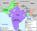
Major Powers and Central Asian Invasions, c. 250 BCE - 550 CE.jpg 1,016 × 1,380; 190 KB
-
Mamluk dynasty 1206 - 1290 ad.GIF 503 × 703; 9 KB
-
Map of 1895 excavations at Pataliputra.jpg 3,542 × 4,899; 1.37 MB
-
Map of Ajatashatru's kingdom.jpg 2,000 × 2,667; 1.96 MB
-
Map of Kuru Kingdom.jpg 741 × 623; 307 KB
-
Map of South India in Late 14th Century.JPG 594 × 502; 106 KB
-
Map of the Senas.png 2,324 × 2,151; 6.57 MB
-
Map of Vedic India ru.png 683 × 489; 389 KB
-
Map of Vedic India.png 683 × 489; 424 KB
-
Map showing the Abhiras of the Konkan.png 641 × 569; 829 KB
-
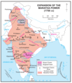
Maratha Empire 1674 - 1818 ad (hy).png 429 × 600; 53 KB
-
Maratha Empire in 1758.png 800 × 928; 381 KB
-
Maratha-Empire-Facts.webp 640 × 325; 23 KB
-
Mauryaempire.jpg 656 × 543; 118 KB
-
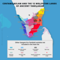
Mozhipeyar regions.png 1,080 × 1,080; 273 KB
-
Mughal-Maratha Wars in 1680 CE.png 8,000 × 4,500; 12.77 MB
-
Nanda Empire.gif 400 × 337; 10 KB
-
Nandas.JPG 438 × 355; 8 KB
-
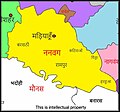
Nanwag map.jpg 1,122 × 1,048; 158 KB
-
NDRF Deployment in India.jpg 1,066 × 1,039; 153 KB
-
NEFA1961.png 1,820 × 1,045; 186 KB
-
Northern Polished Black Ware Culture (700-200 BCE).png 1,050 × 889; 1.55 MB
-
Operation Samudra Setu map.jpg 700 × 400; 123 KB
-
Osi India.png 3,334 × 2,730; 213 KB
-
Oudh in Northern India 1857 map.jpg 902 × 593; 234 KB
-
Painted Grey Ware Culture (1200-600 BCE).png 950 × 702; 1.25 MB
-
Pallava territories.png 270 × 143; 9 KB
-
Pratihara.JPG 434 × 358; 9 KB
-
Rajput mahrajas.JPG 435 × 356; 9 KB
-
Rashtrakuta territories.png 270 × 143; 9 KB
-
Saka-satavahana wars.jpg 668 × 860; 65 KB
-
SatavahanaMap.jpg 1,123 × 1,440; 327 KB
-
Sen Empire.png 1,268 × 1,080; 138 KB
-
Seven River of Regvedas 2014-03-25 13-35.jpg 1,800 × 2,448; 890 KB
-
Sikh Empire.JPG 800 × 655; 251 KB
-
SungaEmpireMap.jpg 1,202 × 1,440; 322 KB
-
Ta-YuanMap.jpg 1,301 × 778; 102 KB
-
The Abhiras at their maximum extent.png 836 × 900; 278 KB
-
The Abhiras during the reign of Ishwarsena.png 836 × 900; 280 KB
-
The Chindaka Nagas of Chakrakota.png 1,600 × 900; 417 KB
-
The eastern Gangetic plain after Ajatasattu's conquest of Kosala.jpg 1,500 × 891; 2.36 MB
-
The eastern Gangetic plain after Bimbisara's conquests.jpg 1,500 × 891; 2.36 MB
-
The eastern Gangetic plain before Bimbisara's conquests.jpg 1,500 × 891; 2.36 MB
-
The Ghaznavid Empire at its maximum extent.png 1,296 × 851; 91 KB
-
The Gupta Empire.gif 827 × 1,000; 59 KB
-
The Nagas at their greatest extent, highlighted in purple.jpg 208 × 243; 7 KB
-
Tughlaq dynasty 1321 - 1398 ad.PNG 503 × 703; 15 KB
-
Van de Brook's map.jpg 1,433 × 1,151; 891 KB
-
Vedic India.jpg 700 × 439; 83 KB
-
Wakatak kingdom.jpg 377 × 265; 41 KB
-
Xuanzang route in India-7thcentury-Telugu.png 527 × 764; 343 KB
-
Территория династии Сатавахана.jpg 520 × 600; 55 KB
-
رحمت پلان.jpg 1,516 × 1,444; 653 KB
-
सिख साम्राज्य का मानचित्र.jpg 1,319 × 1,080; 428 KB
.png/120px-Indus_Valley_Civilization%2C_Mature_Phase_(2600-1900_BCE).png)




.jpg/120px-Chera_country_(early_historic_south_India).jpg)


.png/120px-Early_Vedic_Culture_(1700-1100_BCE).png)





.jpg/120px-Gana_Sanghas_(c._500_BCE).jpg)




.png/120px-India_After_the_Battle_of_Panipat_(1526).png)



-fr.svg/120px-Indus_Valley_Civilization%2C_Early_Phase_(3300-2600_BCE)-fr.svg.png)
.png/120px-Indus_Valley_Civilization%2C_Early_Phase_(3300-2600_BCE).png)
.svg/120px-Indus_Valley_Civilization%2C_Early_Phase_(3300-2600_BCE).svg.png)
-fr.svg/120px-Indus_Valley_Civilization%2C_Late_Phase_(1900-1300_BCE)-fr.svg.png)
.png/120px-Indus_Valley_Civilization%2C_Late_Phase_(1900-1300_BCE).png)
.svg/120px-Indus_Valley_Civilization%2C_Late_Phase_(1900-1300_BCE).svg.png)
-fr.svg/120px-Indus_Valley_Civilization%2C_Mature_Phase_(2600-1900_BCE)-fr.svg.png)
.svg/120px-Indus_Valley_Civilization%2C_Mature_Phase_(2600-1900_BCE).svg.png)



.png/120px-Late_Vedic_Culture_(1100-500_BCE).png)


.png/120px-Magadha_Expansion_(6th-4th_centuries_BCE).png)

_-_ur.png/120px-Mahajanapadas_(c._500_BCE)_-_ur.png)
.png/120px-Mahajanapadas_(c._500_BCE).png)




.png/86px-Maratha_Empire_1674_-_1818_ad_(hy).png)






.png/120px-Northern_Polished_Black_Ware_Culture_(700-200_BCE).png)


.png/120px-Painted_Grey_Ware_Culture_(1200-600_BCE).png)


