Category:Maps of the history of Myanmar
Jump to navigation
Jump to search
Subcategories
This category has the following 12 subcategories, out of 12 total.
1
- 1832 Burmah by Annin & Smith (2 F)
B
E
- Election maps of Myanmar (98 F)
M
- Maps of British Burma (29 F)
- Maps of Konbaung dynasty (7 F)
- Maps of Pagan Kingdom (13 F)
- Maps of State of Burma (2 F)
O
S
- Maps of the Shan States (17 F)
T
- Maps of the Taungoo Dynasty (15 F)
W
Media in category "Maps of the history of Myanmar"
The following 52 files are in this category, out of 52 total.
-
Kukiland.jpg 581 × 345; 39 KB
-
AthiWungyiWar.jpg 562 × 927; 178 KB
-
Attack on Ayutthaya (1549).svg 1,107 × 883; 224 KB
-
AVA KINGDOM.jpg 6,527 × 11,845; 7.7 MB
-
Bangkaeofinal.jpg 632 × 1,003; 206 KB
-
Battle of Naungyo.png 535 × 537; 49 KB
-
Bengale Tiré de "Oud en nieuw Oost-Indien" par François Valentyn (1724-26) Dianga.jpg 2,180 × 1,248; 770 KB
-
Bengale Tiré de "Oud en nieuw Oost-Indien" par François Valentyn (1724-26).jpg 3,150 × 1,873; 1.08 MB
-
Burma (Myanmar) in 1530 km.png 474 × 939; 139 KB
-
Burma (Myanmar) in 1530.png 474 × 939; 135 KB
-
Burma (Myanmar) in 1545.png 474 × 939; 135 KB
-
Burma 1.png 2,140 × 2,590; 311 KB
-
Burma c. 1350.png 474 × 939; 121 KB
-
Burma in 1450-es.svg 593 × 1,181; 1.41 MB
-
Burma in 1450.png 474 × 939; 134 KB
-
Burmese-Siamese War (1759-1760).png 1,000 × 1,800; 403 KB
-
Burmese-Siamese War (1775-1776).png 1,000 × 1,800; 369 KB
-
Burmese-Siamese War (1797-1798).png 2,000 × 3,600; 911 KB
-
Burmese-Siamese War (1802-1805).png 2,000 × 3,600; 959 KB
-
Chiangmai1774.jpg 674 × 1,005; 245 KB
-
Geological Evolution of Myanmar .png 3,694 × 2,656; 1.03 MB
-
Indochina 1300 CE.png 628 × 717; 150 KB
-
Konbaung empire map at its pick.png 529 × 536; 10 KB
-
Manipur map of Khagemba Period.png 838 × 698; 162 KB
-
Manipur of loiyumba period.png 706 × 375; 162 KB
-
Map indianized kingdoms indochina.jpg 963 × 1,003; 223 KB
-
Map of Karenni States-1917.png 1,912 × 1,616; 661 KB
-
Map of Siam (territorial cessions).svg 656 × 1,243; 760 KB
-
Map of Siam and French Indochina -by Milenioscuro- (modified Thai language).png 1,039 × 1,726; 586 KB
-
Map of Siam and French Indochina.svg 748 × 1,243; 1,014 KB
-
Map of the Rattanakosin Kingdom.svg 656 × 1,243; 686 KB
-
Map of the Tea-Horse road.png 800 × 588; 121 KB
-
Map-of-southeast-asia 1300 CE-es.svg 744 × 1,047; 1,015 KB
-
Map-of-southeast-asia 1300 CE.png 800 × 1,125; 251 KB
-
Map-of-southeast-asia 1400 CE-es.svg 791 × 1,114; 535 KB
-
Map-of-southeast-asia 1400 CE.png 791 × 1,114; 190 KB
-
Mongol empire 1290 and the travel of Marco Polo.png 587 × 851; 1.18 MB
-
Mongol invasions of Burma (1277-87)-es.svg 591 × 1,181; 1.3 MB
-
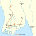
Mongol invasions of Burma (1277-87).png 474 × 939; 120 KB
-
Ninearmieswar.jpg 421 × 931; 129 KB
-
North and South Vietnam.png 922 × 854; 549 KB
-
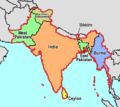
Partition of India.PNG 450 × 400; 27 KB
-
Pyu Realm.png 264 × 583; 51 KB
-
Pyu sites.png 1,176 × 2,271; 91 KB
-
Sirião, Syriam.jpg 2,743 × 2,572; 491 KB
-
Southeast Asian Historical Mandalas.svg 512 × 503; 154 KB
-
Tavoywars.jpg 602 × 918; 157 KB
-
ThalangWar.jpg 496 × 929; 174 KB
-
The Hump and Burma Road.png 1,120 × 796; 343 KB
-
The Tribes Of Burma - map.png 1,862 × 3,072; 1.28 MB
-
VOCBirma.jpg 545 × 525; 59 KB


.svg/120px-Attack_on_Ayutthaya_(1549).svg.png)


_Dianga.jpg/120px-Bengale_Tiré_de_%22Oud_en_nieuw_Oost-Indien%22_par_François_Valentyn_(1724-26)_Dianga.jpg)
.jpg/120px-Bengale_Tiré_de_%22Oud_en_nieuw_Oost-Indien%22_par_François_Valentyn_(1724-26).jpg)
_in_1530_km.png/60px-Burma_(Myanmar)_in_1530_km.png)
_in_1530.png/60px-Burma_(Myanmar)_in_1530.png)
_in_1545.png/60px-Burma_(Myanmar)_in_1545.png)


.png/66px-Burmese-Siamese_War_(1759-1760).png)
.png/66px-Burmese-Siamese_War_(1775-1776).png)
.png/66px-Burmese-Siamese_War_(1797-1798).png)
.png/66px-Burmese-Siamese_War_(1802-1805).png)


.svg/63px-Map_of_Siam_(territorial_cessions).svg.png)
.png/72px-Map_of_Siam_and_French_Indochina_-by_Milenioscuro-_(modified_Thai_language).png)


-es.svg/60px-Mongol_invasions_of_Burma_(1277-87)-es.svg.png)
.png/60px-Mongol_invasions_of_Burma_(1277-87).png)


_(14773048952).jpg/58px-The_military_history_of_the_Madras_engineers_and_pioneers%2C_from_1743_up_to_the_present_time_(1881)_(14773048952).jpg)

