Category:Maps of the history of Pakistan
Jump to navigation
Jump to search
Countries of Asia: Afghanistan · Armenia‡ · Azerbaijan‡ · Bahrain · Bangladesh · Bhutan · Brunei · Cambodia · People's Republic of China · Cyprus‡ · East Timor · Egypt‡ · Georgia‡ · India · Indonesia‡ · Iran · Iraq · Israel · Japan · Jordan · Kazakhstan‡ · Kuwait · Kyrgyzstan · Laos · Lebanon · Malaysia · Mongolia · Myanmar · Nepal · North Korea · Oman · Pakistan · Philippines · Qatar · Russia‡ · Saudi Arabia · Singapore · South Korea · Sri Lanka · Syria · Tajikistan · Thailand · Turkey‡ · Turkmenistan · United Arab Emirates · Uzbekistan · Vietnam · Yemen
Limited recognition: Abkhazia‡ · Taiwan · Northern Cyprus‡ · State of Palestine · South Ossetia‡
‡: partly located in Asia
Limited recognition: Abkhazia‡ · Taiwan · Northern Cyprus‡ · State of Palestine · South Ossetia‡
‡: partly located in Asia
Use the appropriate category for maps showing all or a large part of Pakistan. See subcategories for smaller areas:
| If the map shows | Category to use |
|---|---|
| Pakistan on a recently created map | Category:Maps of Pakistan or its subcategories |
| Pakistan on a map created more than 70 years ago | Category:Old maps of Pakistan or its subcategories |
| the history of Pakistan on a recently created map | Category:Maps of the history of Pakistan or its subcategories |
| the history of Pakistan on a map created more than 70 years ago | Category:Old maps of the history of Pakistan or its subcategories |
Subcategories
This category has the following 33 subcategories, out of 33 total.
!
A
C
D
- Maps of the Durrani Empire (13 F)
F
G
- Maps of the Ghaznavid Empire (30 F)
- Maps of the Ghurid Empire (11 F)
H
- Maps of the Hephthalites (16 F)
I
- Maps of the Indo-Greek Kingdom (31 F)
K
- Maps of the Kushan Empire (26 F)
M
- Maps of the Gupta Empire (51 F)
- Maps of the Maratha Confederacy (53 F)
- Maps of the Mauryan Empire (82 F)
- Maps of the Samanid Empire (18 F)
O
P
- Maps of the Pala Empire (7 F)
S
T
- Maps of the Timurid Empire (95 F)
Pages in category "Maps of the history of Pakistan"
This category contains only the following page.
Media in category "Maps of the history of Pakistan"
The following 48 files are in this category, out of 48 total.
-
2008 Quetta Pakistan earthquake.jpg 612 × 719; 132 KB
-
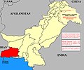
Pakistan-Waziristan-Map.png 700 × 692; 96 KB
-
AlexanderIndiaMap-es.svg 563 × 673; 43.19 MB
-
AlexanderIndiaMap.jpg 1,112 × 1,388; 275 KB
-
Arabsum5.png 1,000 × 1,066; 294 KB
-
Arabsumf.png 1,000 × 1,056; 319 KB
-
Arabsumf1.png 1,000 × 1,056; 335 KB
-
Asia 001ad.jpg 2,048 × 1,181; 751 KB
-
Asia 400ad (cropped).jpg 754 × 633; 184 KB
-
Asia 400ad.jpg 1,990 × 1,211; 790 KB
-
Bactriane, Gandhara.jpg 1,559 × 1,272; 2.04 MB
-
Baluchistan Agency 1931 Map.png 2,000 × 1,612; 370 KB
-
Battle of Saragarhi.png 508 × 293; 251 KB
-
Gandhara, Alfred Foucher 1905.jpg 4,157 × 3,129; 3.62 MB
-
Gupta Empire 320 - 600 ad.PNG 503 × 703; 24 KB
-
Historical Pakistan - it.gif 634 × 646; 28 KB
-
Historical Pakistan.gif 634 × 646; 21 KB
-
Imperio Sij.JPG 800 × 655; 124 KB
-
Indo-ScythiansMap.jpg 1,804 × 2,160; 628 KB
-
Khost and Waziristans.jpg 542 × 642; 356 KB
-
Largest Hindu Caste by District (Census 1931).jpg 781 × 592; 125 KB
-
Makran Pakistan.jpg 722 × 600; 90 KB
-
Map of Ardashir & shapur's campaign.jpg 1,172 × 723; 347 KB
-
Map of Vedic India ru.png 683 × 489; 389 KB
-
Map of Vedic India.png 683 × 489; 424 KB
-
Mapofgreaterpakistan.png 375 × 375; 73 KB
-
Median Empire-The first half of the 6th century BC.png 1,619 × 925; 214 KB
-
PAK1971PL.jpg 569 × 554; 271 KB
-
Pakistan 1971.png 532 × 405; 18 KB
-
Pakistan-1971.png 500 × 416; 106 KB
-
Paquistão P011.jpg 2,365 × 1,763; 994 KB
-
Pratihara.JPG 434 × 358; 9 KB
-
Princely states of Pakistan map.gif 700 × 600; 113 KB
-
QASIM-ar.png 459 × 400; 111 KB
-
QASIM.PNG 459 × 400; 87 KB
-
Rajput mahrajas.JPG 435 × 356; 9 KB
-
SakastanMap.jpg 1,356 × 1,109; 258 KB
-
SE Asia 400ad.jpg 1,475 × 1,092; 652 KB
-
Sikh Empire-ml.png 800 × 655; 239 KB
-
Sikh Empire.JPG 800 × 655; 251 KB
-
Sindh 700ad-ar.png 720 × 473; 685 KB
-
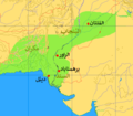
Sindh 700ad.jpg 720 × 473; 432 KB
-
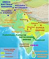
SungaEmpireMap.jpg 1,202 × 1,440; 322 KB
-
Talpur Map 1823.png 624 × 496; 46 KB
-
Vedic India.jpg 700 × 439; 83 KB
-
WKshatrapas.jpg 1,121 × 1,440; 309 KB
-
فتوح قتيبة بن مسلم ومحمد بن القاسم.jpg 669 × 975; 234 KB
-
सिख साम्राज्य का मानचित्र.jpg 1,319 × 1,080; 428 KB



.jpg/120px-Asia_400ad_(cropped).jpg)



.jpg/120px-Largest_Hindu_Caste_by_District_(Census_1931).jpg)
