Category:Maps of the Indo-Greek Kingdom
Jump to navigation
Jump to search
Français : Cartes du royaume indo-grec
Media in category "Maps of the Indo-Greek Kingdom"
The following 31 files are in this category, out of 31 total.
-
AlexanderIndiaMap-es.svg 563 × 673; 43.19 MB
-
AlexanderIndiaMap.jpg 1,112 × 1,388; 275 KB
-
Asia 001ad.jpg 2,048 × 1,181; 751 KB
-
Asia 100bc.jpg 2,053 × 1,196; 760 KB
-
AtlasIndoGreek.jpg 1,200 × 1,440; 359 KB
-
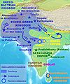
Carte royaume indo-grec.jpg 462 × 504; 42 KB
-
EasternSatrapsAfterAlexander-es.svg 577 × 673; 40.51 MB
-
EasternSatrapsAfterAlexander.jpg 1,119 × 1,393; 324 KB
-
Indo-greek Indian Dravidian.png 2,822 × 3,375; 2.97 MB
-
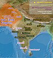
Indo-Greek-territory revision1.jpg 396 × 437; 172 KB
-
Indo-GreekCompromiseMap.jpg 1,204 × 1,440; 363 KB
-
Indo-GreekKingdomMap.jpg 462 × 504; 133 KB
-
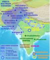
Indo-GreekKingdomMap11.jpg 462 × 504; 61 KB
-
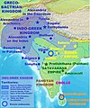
Indo-GreekKingdomMap3.jpg 462 × 504; 136 KB
-
Indo-GreekMapColor.jpg 1,202 × 1,440; 351 KB
-
Indo-Greeks 100bc.jpg 880 × 659; 696 KB
-
Indo-GreekWestermansNarain-es.svg 851 × 1,017; 641 KB
-
Indo-GreekWestermansNarain.jpg 1,203 × 1,440; 376 KB
-
IndoGreekCampaings.jpg 901 × 1,080; 221 KB
-
IndoGreekCompromiseMap-ar.jpg 900 × 1,080; 406 KB
-
IndoGreekCompromiseMap.jpg 903 × 1,080; 214 KB
-
IndoGreekKingdom-pt.svg 1,035 × 1,046; 493 KB
-
IndoGreekKingdomAndCampaigns-es.svg 1,035 × 1,046; 590 KB
-
IndoGreekKingdomAndCampaigns-pt.svg 1,035 × 1,046; 509 KB
-
IndoGreekKingdomAndCampaigns.svg 970 × 981; 893 KB
-
IndoGreekMap.jpg 1,288 × 1,440; 266 KB
-
Map of the Indo-Greeks.png 2,324 × 2,151; 7.37 MB
-
Periplus World Map.jpg 2,142 × 1,774; 785 KB
-
Reiaumes Indogrècs.png 1,310 × 1,306; 180 KB
-
SungaEmpireMap.jpg 1,202 × 1,440; 322 KB
-
Ινδοελληνικό βασίλειο.svg 970 × 981; 322 KB


