Category:Maps of the Western Roman Empire
Jump to navigation
Jump to search
Media in category "Maps of the Western Roman Empire"
The following 116 files are in this category, out of 116 total.
-
4KTHEODOSIAN.png 3,840 × 2,160; 555 KB
-
628px-Western and Eastern Roman Empires 476AD(3).PNG 528 × 259; 11 KB
-
628px-Western-Eastern-Roman-Empires-476AD.PNG 528 × 259; 17 KB
-
Carte des peuples francs (IIIe siècle) hu.svg 1,704 × 1,751; 66 KB
-
Carte des peuples francs (IIIe siècle) nl.svg 1,704 × 1,751; 331 KB
-
Carte des peuples francs (IIIe siècle)-pt.svg 1,704 × 1,751; 63 KB
-
Carte des peuples francs (IIIe siècle).svg 1,704 × 1,751; 473 KB
-
Carte Empire Romain - 1663.jpg 6,912 × 4,032; 10.46 MB
-
Crossing of the Rhine map.jpg 5,476 × 3,310; 7.07 MB
-
De Franken tussen 400 en 440 jp.svg 2,323 × 1,729; 660 KB
-
De Franken tussen 400 en 440 nl.svg 2,323 × 1,729; 644 KB
-
Diocese of Africa - AD 400.png 1,697 × 1,175; 1.94 MB
-
Diocese of Macedonia - AD 400.png 732 × 702; 572 KB
-
Eastern Roman Empire 476.png 3,998 × 1,835; 656 KB
-
EasternRomanEmpire.png 250 × 175; 7 KB
-
End of the Western Roman Empire.480AD.png 795 × 600; 125 KB
-
Eroberungen des Chlodio.png 1,395 × 1,056; 334 KB
-
Europe in the Migration Period in the 4th and 5th centuries.jpg 5,476 × 3,310; 4.33 MB
-
Extent of Western Roman Empire 395.png 493 × 548; 40 KB
-
Folkevandringene.jpg 1,400 × 991; 286 KB
-
Franken Expans1.jpg 1,009 × 868; 250 KB
-
Franken Expansion bis 6Jhdt.png 2,102 × 1,674; 856 KB
-
Gaule romaine - 1738.jpg 8,411 × 6,144; 18.94 MB
-
Guerra civil romana (406-411) 1.svg 1,220 × 1,236; 1.01 MB
-
Guerra civil romana (406-411) 2.svg 1,220 × 1,236; 1.09 MB
-
Guerra civil romana (406-411) 3.svg 1,220 × 1,236; 1.08 MB
-
Guerra civil romana (406-411) 4.svg 1,220 × 1,236; 1.09 MB
-
Guerra civil romana (413).svg 1,220 × 1,236; 1.11 MB
-
Heinrich Kiepert. Hispania, Mauretania et Africa.jpg 8,499 × 5,638; 8.15 MB
-
Illyricum & Dacia - AD 400.png 971 × 673; 972 KB
-
Image taken from page 531 of 'Histoire universelle' (11147289716).jpg 2,208 × 1,407; 706 KB
-
Image taken from page 531 of 'Histoire universelle' (15970457313).jpg 756 × 984; 186 KB
-
Impero d'Occidente 410.PNG 900 × 595; 123 KB
-
Impero d'Occidente 445.PNG 900 × 595; 124 KB
-
Invasi bangsa barbar ke Romawi.svg 1,800 × 1,300; 236 KB
-
Invasioni dell'Impero Romano.png 1,962 × 1,374; 200 KB
-
Invasions of the Roman Empire 1.png 1,954 × 1,382; 269 KB
-
Invasions of the Roman Empire Arabic.png 2,943 × 2,061; 932 KB
-
Invasions of the Roman Empire Dutch.svg 1,766 × 1,237; 676 KB
-
Invasions of the Roman Empire el.svg 1,766 × 1,237; 162 KB
-
Invasions of the Roman Empire Greek.png 1,766 × 1,239; 547 KB
-
Italia Annonaria ca 400 AD.png 690 × 518; 573 KB
-
Les Francs en Belgique romaine-de.svg 1,280 × 883; 553 KB
-
Les Francs en Belgique romaine-es.svg 1,280 × 883; 382 KB
-
Les Francs en Belgique romaine-pt.svg 1,280 × 883; 35 KB
-
Les Francs en Belgique romaine-ru.svg 1,280 × 883; 62 KB
-
Les Francs en Belgique romaine.svg 1,280 × 883; 353 KB
-
Les Francs entre 400 et 440-es.svg 2,323 × 1,729; 355 KB
-
Les Francs entre 400 et 440-pt.svg 2,323 × 1,729; 62 KB
-
Les Francs entre 400 et 440.svg 2,323 × 1,729; 430 KB
-
MajorianEmpire.png 1,220 × 1,385; 1.51 MB
-
Mapa de la Galia en 419.svg 2,097 × 1,893; 1.19 MB
-
Mapa defensas de la Galia en 406.svg 2,097 × 1,893; 1.31 MB
-
Mapa diocesis de Galia.svg 2,097 × 1,893; 1.01 MB
-
Mapa diocesis de Italia Anonaria.svg 2,097 × 1,893; 1.06 MB
-
Mapa diocesis de las Siete Provincias.svg 2,097 × 1,893; 1.08 MB
-
Mapa diocesis de Panonia.svg 2,097 × 1,893; 1.08 MB
-
Mapa diocesis Italia Suburbicaria.svg 2,097 × 1,893; 1.09 MB
-
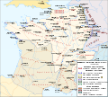
Mapa Imperio Occidental (migración año 406).svg 1,220 × 1,236; 1.1 MB
-
Mapa Imperio Occidental (reparto Hipania en 411).svg 1,220 × 1,236; 961 KB
-
Mapa Imperio Occidental año 400 (general).svg 1,220 × 1,236; 974 KB
-
Mapa Imperio Occidental año 408.svg 1,220 × 1,235; 998 KB
-
Mapa Imperio Occidental año 410.svg 1,220 × 1,235; 960 KB
-
Mapa Imperio Occidental año 413.svg 1,220 × 1,235; 979 KB
-
Mapa Imperio Occidental año 418.svg 1,220 × 1,235; 985 KB
-
Mapa Imperio Romano 395 (administrativo).svg 2,565 × 1,906; 1.99 MB
-
Mapa invasion Galia 407-409.svg 2,097 × 1,893; 1.51 MB
-
MapaWielkiejWedrowkiLudow.png 1,218 × 730; 232 KB
-
Mappa Impero Romano.png 746 × 518; 17 KB
-
Moesia - AD 400.png 860 × 596; 756 KB
-
Regni romano barbarici.png 746 × 512; 16 KB
-
Regno di Soissons.png 401 × 256; 11 KB
-
Reichsteilung-zh.svg 2,562 × 1,516; 424 KB
-
Reichsteilung.svg 2,050 × 1,213; 1.18 MB
-
Roman Britain - AD 400-zh.svg 914 × 568; 764 KB
-
Roman Britain - AD 400.png 793 × 595; 271 KB
-
Roman empire 395.jpg 2,316 × 1,861; 1.87 MB
-
Roman Empire 460 AD.png 694 × 396; 12 KB
-
Roman Empire 460 CE-de.svg 1,220 × 1,385; 2.49 MB
-
Roman Empire 460 CE-es.svg 1,220 × 1,385; 2.8 MB
-
Roman Empire 460 CE-hu.svg 1,220 × 1,385; 2.47 MB
-
Roman Empire 460 CE-pt.svg 1,220 × 1,385; 2.5 MB
-
Roman Empire 460 CE.svg 1,220 × 1,385; 2.5 MB
-
Roman Empire 460 pl.svg 1,220 × 1,385; 2.5 MB
-
Roman Empire 460.png 1,131 × 808; 162 KB
-
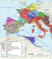
Roman Empire under Majorian (460 CE) pl.png 1,220 × 1,385; 1.47 MB
-
Roman Empire under Majorian (460 CE).png 1,220 × 1,385; 1.47 MB
-
Roman Gaul - AD 400-zh.svg 1,264 × 771; 1.43 MB
-
Roman Gaul - AD 400.png 1,369 × 833; 1.13 MB
-
Roman Italy - AD 400.png 1,162 × 1,446; 2.02 MB
-
Roman Spain - AD 400-zh.svg 3,573 × 2,438; 1.56 MB
-
Roman Spain - AD 400.png 1,156 × 869; 1.14 MB
-
Roman-empire-mod.jpg 620 × 500; 141 KB
-
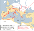
Routes of the barbarian invaders, 5th century AD-zh-classical.png 624 × 575; 33 KB
-
Routes of the barbarian invaders, 5th century AD.gif 624 × 575; 44 KB
-
The Roman Empire ca 400 AD (Danube provinces).png 1,603 × 765; 1.9 MB
-
The Roman Empire ca 400 AD.png 4,339 × 2,689; 12.8 MB
-
The Roman Empire ca. 400 AD-zh.svg 3,963 × 2,438; 10.78 MB
-
The Roman Empire ca. 400 AD.svg 3,170 × 1,950; 6.53 MB
-
Tripolitania within the Diocese of Africa - AD 400 (cropped).png 905 × 336; 202 KB
-
Western and Eastern Roman Empires 476AD(3).svg 660 × 324; 141 KB
-
Western and Eastern Roman Empires 476AD-es.svg 1,914 × 946; 202 KB
-
Western Roman Empire 3500.png 3,500 × 3,323; 1.96 MB
-
Western Roman Empire 395 Tribes.png 1,704 × 1,744; 1.82 MB
-
Western Roman Empire 395.png 1,704 × 1,744; 1.79 MB
-
Western Roman Empire 409.png 3,500 × 3,323; 703 KB
-
Western Roman Empire in 450-fr.svg 469 × 377; 48 KB
-
Western Roman Empire.png 563 × 406; 9 KB
-
Western-mediterranean-rome-hadrian.jpg 800 × 600; 437 KB
-
Western-Roman-Empire-AD395.png 493 × 548; 29 KB
-
Westrom zwischen 450 und 476.jpg 672 × 475; 316 KB
-
对罗马帝国的入侵.png 1,962 × 1,374; 279 KB
_-_Geographicus_-_RomanEmpireWest-anville-1763.jpg/96px-1763_Anville_Map_of_the_Western_Roman_Empire_(including_Italy)_-_Geographicus_-_RomanEmpireWest-anville-1763.jpg)
_-_Geographicus_-_RomanEmpireWest-anville-1794.jpg/95px-1794_Anville_Map_of_the_Western_Roman_Empire_(includes_Italy)_-_Geographicus_-_RomanEmpireWest-anville-1794.jpg)

.PNG/120px-628px-Western_and_Eastern_Roman_Empires_476AD(3).PNG)


_hu.svg/117px-Carte_des_peuples_francs_(IIIe_siècle)_hu.svg.png)
_nl.svg/117px-Carte_des_peuples_francs_(IIIe_siècle)_nl.svg.png)
-pt.svg/117px-Carte_des_peuples_francs_(IIIe_siècle)-pt.svg.png)
.svg/117px-Carte_des_peuples_francs_(IIIe_siècle).svg.png)


_1.svg/118px-Guerra_civil_romana_(406-411)_1.svg.png)
_2.svg/118px-Guerra_civil_romana_(406-411)_2.svg.png)
_3.svg/118px-Guerra_civil_romana_(406-411)_3.svg.png)
_4.svg/118px-Guerra_civil_romana_(406-411)_4.svg.png)
.svg/118px-Guerra_civil_romana_(413).svg.png)


.jpg/120px-Image_taken_from_page_531_of_%27Histoire_universelle%27_(11147289716).jpg)
.jpg/92px-Image_taken_from_page_531_of_%27Histoire_universelle%27_(15970457313).jpg)




.svg/118px-Mapa_Imperio_Occidental_(migración_año_406).svg.png)
.svg/118px-Mapa_Imperio_Occidental_(reparto_Hipania_en_411).svg.png)
.svg/118px-Mapa_Imperio_Occidental_año_400_(general).svg.png)


.svg/120px-Mapa_Imperio_Romano_395_(administrativo).svg.png)




_pl.png/106px-Roman_Empire_under_Majorian_(460_CE)_pl.png)
.png/106px-Roman_Empire_under_Majorian_(460_CE).png)


.png/120px-The_Roman_Empire_ca_400_AD_(Danube_provinces).png)


.svg/120px-Western_and_Eastern_Roman_Empires_476AD(3).svg.png)

