File:Monetazione campana III secolo.svg
From Wikimedia Commons, the free media repository
Jump to navigation
Jump to search

Size of this PNG preview of this SVG file: 691 × 600 pixels. Other resolutions: 277 × 240 pixels | 553 × 480 pixels | 885 × 768 pixels | 1,180 × 1,024 pixels | 2,360 × 2,048 pixels | 1,088 × 944 pixels.
Original file (SVG file, nominally 1,088 × 944 pixels, file size: 448 KB)
File information
Structured data
Captions
Captions
Add a one-line explanation of what this file represents
| DescriptionMonetazione campana III secolo.svg |
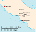
English: map of Campanian mints in III century BC (in Italian)
Italiano: cartina delle zecche campane nel III secolo a.C. |
||
| Date | (UTC) | ||
| Source | Kingdom of Italy 1919 map.svg | ||
| Author | |||
| SVG development InfoField | This W3C-invalid map was created with Adobe Illustrator.
|
| Public domainPublic domainfalsefalse |
| I, the copyright holder of this work, release this work into the public domain. This applies worldwide. In some countries this may not be legally possible; if so: I grant anyone the right to use this work for any purpose, without any conditions, unless such conditions are required by law. |
Original upload log[edit]
This image is a derivative work of the following images:
- File:Kingdom_of_Italy_1919_map.svg licensed with PD-self, PD-user
- 2009-05-02T11:37:55Z F l a n k e r 3360x3950 (875816 Bytes) + Tende
- 2009-05-01T09:50:38Z F l a n k e r 3360x3950 (884971 Bytes) + Kvarner's islands
- 2009-04-30T06:43:54Z F l a n k e r 3360x3950 (869412 Bytes) + San Marino
- 2009-04-11T16:33:59Z Rhegion 3360x3950 (868695 Bytes) aggiunta Reggio
- 2008-08-09T10:00:21Z F l a n k e r 3360x3950 (868475 Bytes) Removed Latina (not present in 1919)
- 2008-03-14T19:15:32Z F l a n k e r 3360x3950 (869311 Bytes) Colours
- 2008-03-14T19:07:53Z F l a n k e r 3360x3950 (869240 Bytes) Minor improvements (previous upload was an error)
- 2008-03-14T19:04:32Z F l a n k e r 3360x3950 (505581 Bytes) Minor improvements
- 2007-12-04T10:38:24Z Salli 3360x3950 (505581 Bytes) Update
- 2007-11-04T19:17:31Z F l a n k e r 3360x3950 (868898 Bytes) Width
- 2007-11-04T19:13:23Z F l a n k e r 3245x3948 (859222 Bytes) Updated colours and boundaries (Fiume, Zara, Cazza, Lagosta, Pelagosa, Saseno).
- 2007-05-03T10:39:07Z F l a n k e r 3245x3948 (542132 Bytes)
- 2007-05-02T21:57:35Z F l a n k e r 3245x3948 (545928 Bytes) {{Information |Description={{en|map of the Kingdom of Italy (Regno d'Italia) in 1919.}} {{it|cartina del Regno d'Italia nel 1919.}} |Source=self-made |Date=2 March 2007 |Author= [[User:F l a n k e r|F l a n k e r]] }} [[Cate
File history
Click on a date/time to view the file as it appeared at that time.
| Date/Time | Thumbnail | Dimensions | User | Comment | |
|---|---|---|---|---|---|
| current | 11:45, 27 November 2009 |  | 1,088 × 944 (448 KB) | Carlomorino (talk | contribs) | {{Information |Description={{en|map of Campanian mints in III century BC (in Italian)}} {{it|cartina delle zecche campane nel III secolo a.C.}} |Source=*File:Kingdom_of_Italy_1919_map.svg |Date=2009-11-27 11:43 (UTC) |Author=*[[:File:Kingdom_of_Ital |
You cannot overwrite this file.
File usage on Commons
The following page uses this file:
File usage on other wikis
The following other wikis use this file:
- Usage on en.wikipedia.org
- Usage on it.wikipedia.org